The Effect of Administrative Boundaries and Geocoding Error on Cancer Rates in California
Supporting Files

-
4-2012
File Language:
English
Details
-
Alternative Title:Spat Spatiotemporal Epidemiol
-
Personal Author:
-
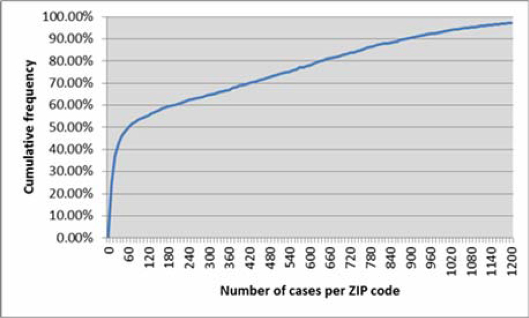
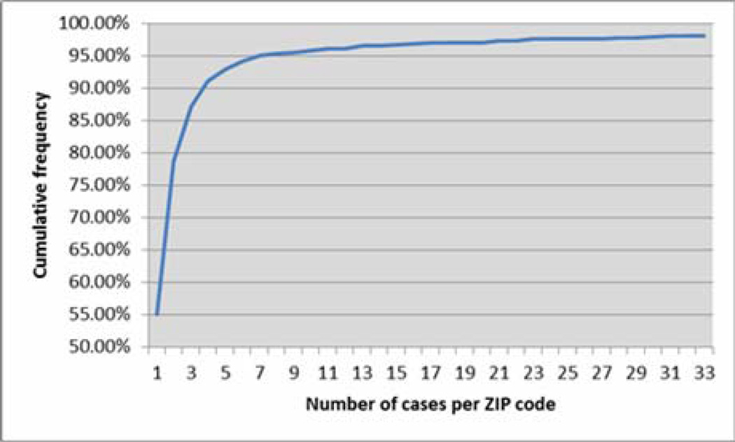
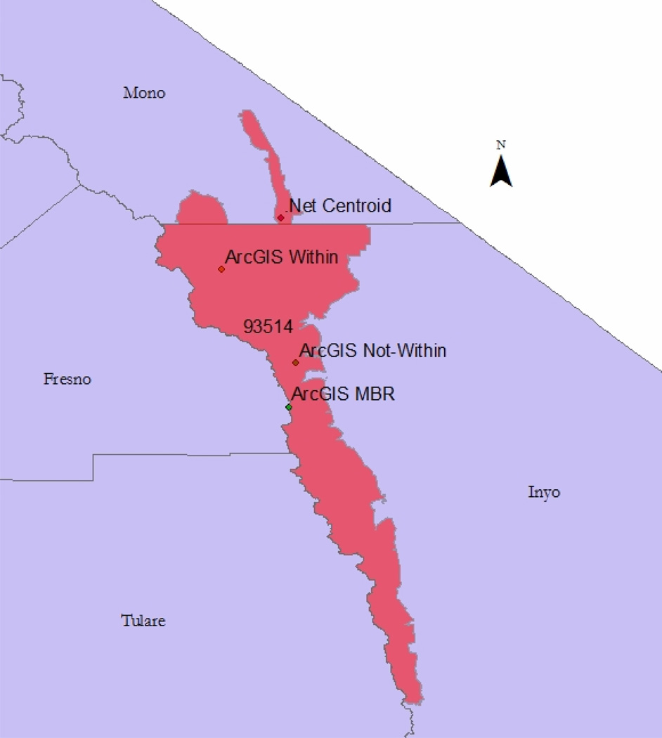
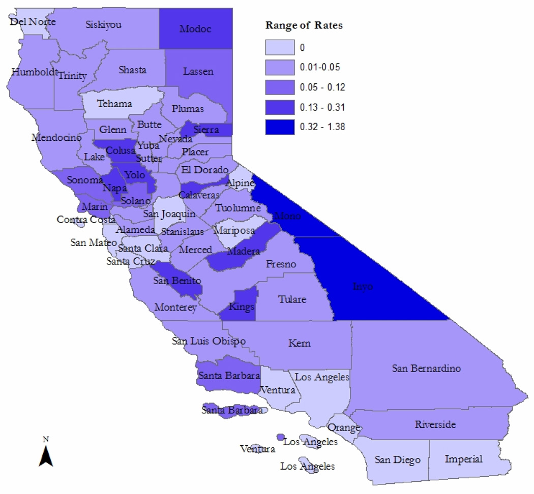
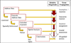
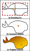
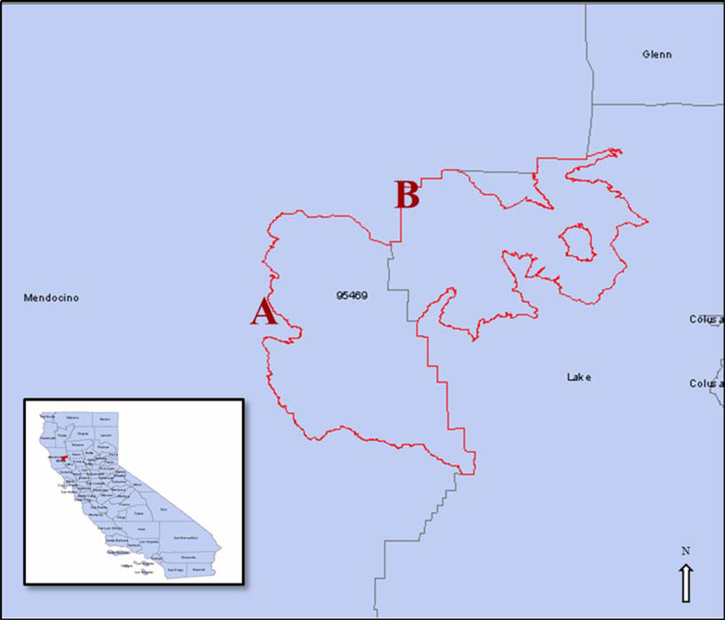
Description:Geocoding is often used to produce maps of disease rates from the diagnosis addresses of incident cases to assist with disease surveillance, prevention, and control. In this process, diagnosis addresses are converted into latitude/longitude pairs which are then aggregated to produce rates at varying geographic scales such as Census tracts, neighborhoods, cities, counties, and states. The specific techniques used within geocoding systems have an impact on where the output geocode is located and can therefore have an effect on the derivation of disease rates at different geographic aggregations. This paper investigates how county-level cancer rates are affected by the choice of interpolation method when case data are geocoded to the ZIP code level. Four commonly used areal unit interpolation techniques are applied and the output of each is used to compute crude county-level five-year incidence rates of all cancers in California. We found that the rates observed for 44 out of the 58 counties in California vary based on which interpolation method is used, with rates in some counties increasing by nearly 400% between interpolation methods.
-
Keywords:
-
Source:Spat Spatiotemporal Epidemiol. 2012; 3(1):39-54
-
Pubmed ID:22469490
-
Pubmed Central ID:PMC3324674
-
Document Type:
-
Funding:P30 ES007048/ES/NIEHS NIH HHSUnited States/ ; N01 PC035139/PC/NCI NIH HHSUnited States/ ; N01-PC-35139/PC/NCI NIH HHSUnited States/ ; H13 EH000793/EH/NCEH CDC HHSUnited States/ ; 1H13EH000793-01/EH/NCEH CDC HHSUnited States/ ; R01 CA195218/CA/NCI NIH HHSUnited States/ ; P30 ES007048-12/ES/NIEHS NIH HHSUnited States/ ; N01PC35139/CA/NCI NIH HHSUnited States/ ; 5P30ES007048/ES/NIEHS NIH HHSUnited States/
-
Volume:3
-
Issue:1
-
Collection(s):
-
Main Document Checksum:urn:sha256:321be3516484c03f8f8c907eaef8ea2815d535d7b958bf3a585ec5e967c3978a
-
Download URL:
-
File Type:
 [PDF
- 3.88 MB
]
[PDF
- 3.88 MB
]
Supporting Files

File Language:
English
ON THIS PAGE

CDC STACKS serves as an archival repository of CDC-published products including
scientific findings,
journal articles, guidelines, recommendations, or other public health information authored or
co-authored by CDC or funded partners.
As a repository, CDC STACKS retains documents in their original published format to ensure public access to scientific information.
As a repository, CDC STACKS retains documents in their original published format to ensure public access to scientific information.
You May Also Like
COLLECTION
CDC Public Access