Remote Sensing of Climatic Anomalies and West Nile Virus Incidence in the Northern Great Plains of the United States
Supporting Files
Public Domain

-
Oct 05 2012
File Language:
English
Details
-
Alternative Title:PLoS One
-
Personal Author:
-
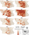
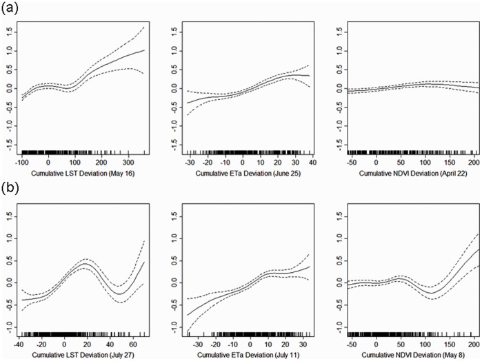
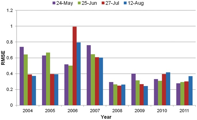
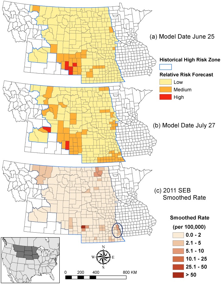
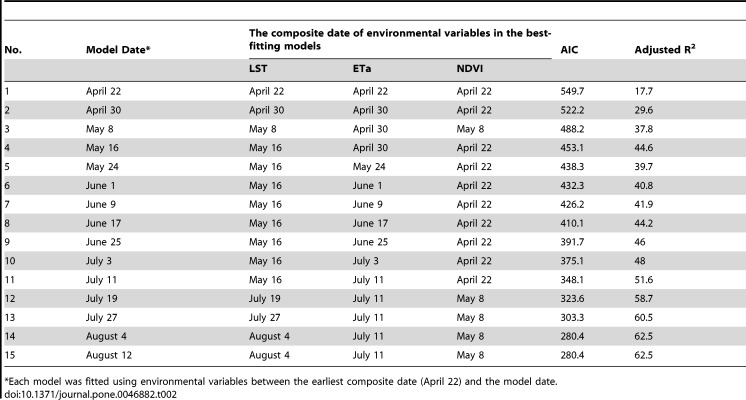
Description:The northern Great Plains (NGP) of the United States has been a hotspot of West Nile virus (WNV) incidence since 2002. Mosquito ecology and the transmission of vector-borne disease are influenced by multiple environmental factors, and climatic variability is an important driver of inter-annual variation in WNV transmission risk. This study applied multiple environmental predictors including land surface temperature (LST), the normalized difference vegetation index (NDVI) and actual evapotranspiration (ETa) derived from Moderate-Resolution Imaging Spectroradiometer (MODIS) products to establish prediction models for WNV risk in the NGP. These environmental metrics are sensitive to seasonal and inter-annual fluctuations in temperature and precipitation, and are hypothesized to influence mosquito population dynamics and WNV transmission. Non-linear generalized additive models (GAMs) were used to evaluate the influences of deviations of cumulative LST, NDVI, and ETa on inter-annual variations of WNV incidence from 2004-2010. The models were sensitive to the timing of spring green up (measured with NDVI), temperature variability in early spring and summer (measured with LST), and moisture availability from late spring through early summer (measured with ETa), highlighting seasonal changes in the influences of climatic fluctuations on WNV transmission. Predictions based on these variables indicated a low WNV risk across the NGP in 2011, which is concordant with the low case reports in this year. Environmental monitoring using remote-sensed data can contribute to surveillance of WNV risk and prediction of future WNV outbreaks in space and time.
-
Subjects:
-
Source:PLoS One. 2012; 7(10).
-
Document Type:
-
Place as Subject:
-
Volume:7
-
Issue:10
-
Collection(s):
-
Main Document Checksum:urn:sha256:79f9d98f629bc9a37c93b3bb266d41286063cfbfb1cc444e7665b81d1f44a881
-
Download URL:
-
File Type:
 [PDF
- 1.27 MB
]
[PDF
- 1.27 MB
]
Supporting Files

File Language:
English
ON THIS PAGE

CDC STACKS serves as an archival repository of CDC-published products including
scientific findings,
journal articles, guidelines, recommendations, or other public health information authored or
co-authored by CDC or funded partners.
As a repository, CDC STACKS retains documents in their original published format to ensure public access to scientific information.
As a repository, CDC STACKS retains documents in their original published format to ensure public access to scientific information.
You May Also Like
COLLECTION
CDC Public Access