
i
A BAYESIAN SPATIAL AND TEMPORAL MODELING APPROACH TO MAPPING GEOGRAPHIC VARIATION IN MORTALITY RATES FOR SUBNATIONAL AREAS WITH R-INLA
-
1 2018
Source: J Data Sci. 16(1):147-182
 [PDF-2.65 MB]
Details:
-
Alternative Title:J Data Sci
-
Personal Author:
-
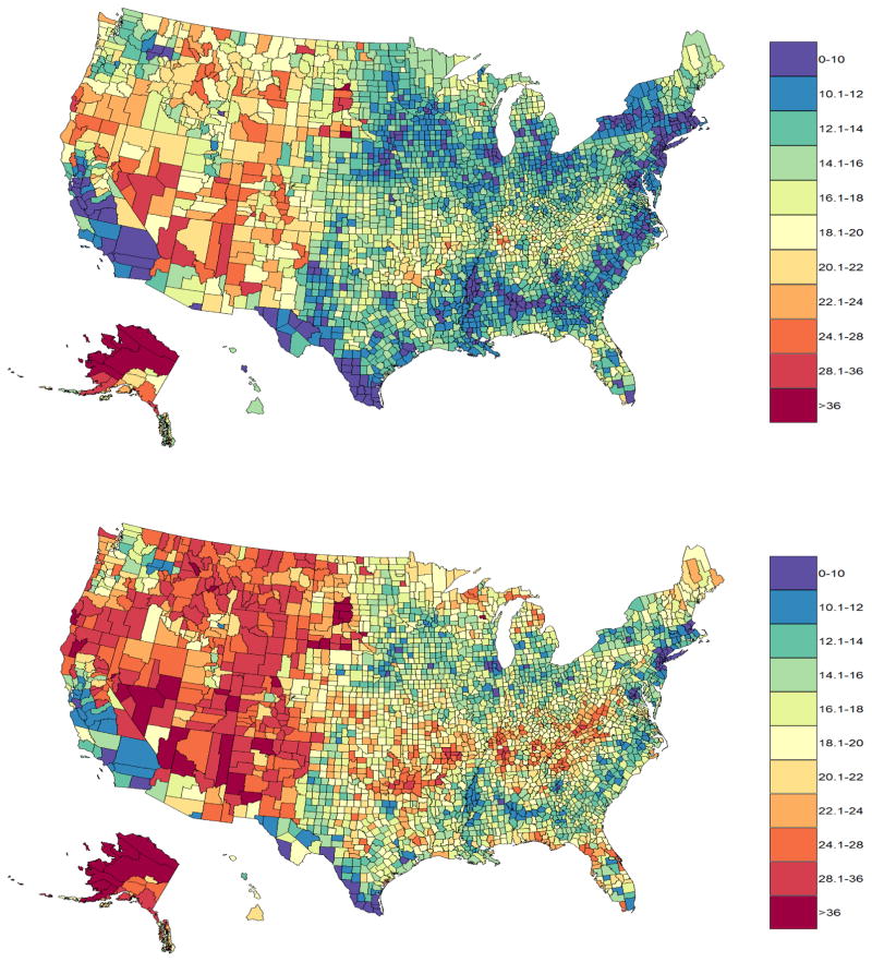
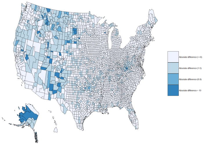
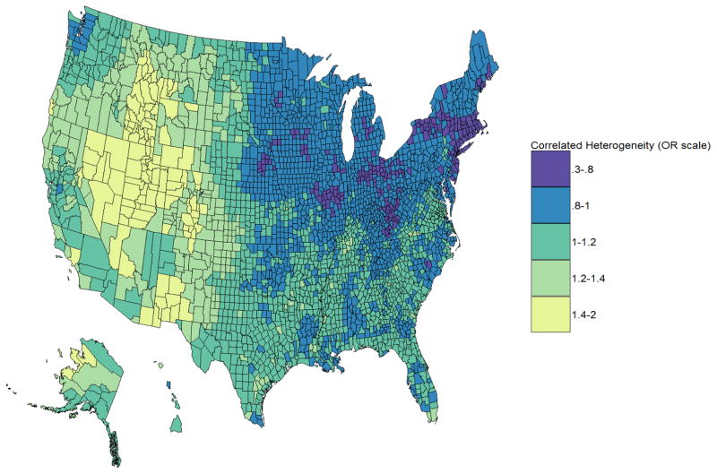
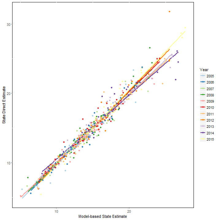
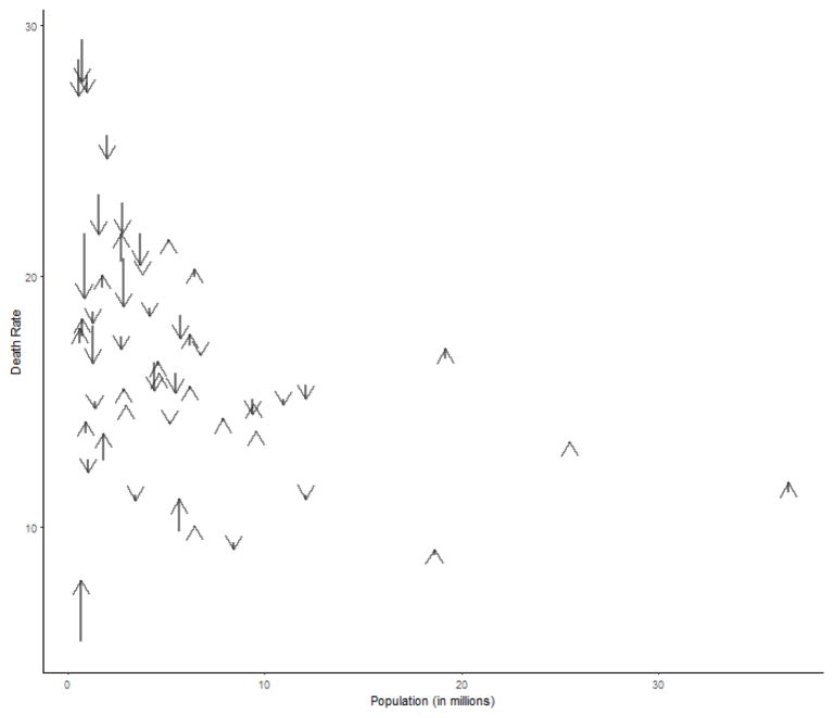
Description:Hierarchical Bayes models have been used in disease mapping to examine small scale geographic variation. State level geographic variation for less common causes of mortality outcomes have been reported however county level variation is rarely examined. Due to concerns about statistical reliability and confidentiality, county-level mortality rates based on fewer than 20 deaths are suppressed based on Division of Vital Statistics, National Center for Health Statistics (NCHS) statistical reliability criteria, precluding an examination of spatio-temporal variation in less common causes of mortality outcomes such as suicide rates (SRs) at the county level using direct estimates. Existing Bayesian spatio-temporal modeling strategies can be applied via Integrated Nested Laplace Approximation (INLA) in R to a large number of rare causes of mortality outcomes to enable examination of spatio-temporal variations on smaller geographic scales such as counties. This method allows examination of spatiotemporal variation across the entire U.S., even where the data are sparse. We used mortality data from 2005-2015 to explore spatiotemporal variation in SRs, as one particular application of the Bayesian spatio-temporal modeling strategy in R-INLA to predict year and county-specific SRs. Specifically, hierarchical Bayesian spatio-temporal models were implemented with spatially structured and unstructured random effects, correlated time effects, time varying confounders and space-time interaction terms in the software R-INLA, borrowing strength across both counties and years to produce smoothed county level SRs. Model-based estimates of SRs were mapped to explore geographic variation.
-
Keywords:
-
Source:
-
Pubmed ID:29520299
-
Pubmed Central ID:PMC5839164
-
Document Type:
-
Collection(s):
-
Main Document Checksum:
-
Download URL:
-
File Type:
Supporting Files
-

gif 
jpeg 
gif 
jpeg 
gif 
jpeg 
gif 
jpeg 
pdf 
xml 
gif 
jpeg 
gif 
jpeg 
gif 
jpeg


More +
You May Also Like
 [PDF - 3.37 MB]

 Email
CDC-INFO
Email
CDC-INFO


