i
Analyses of geological and hydrodynamic controls on methane emissions experienced in a Lower Kittanning coal mine
-
8 1 2012
-
Source: Int J Coal Geol. 98:110-127
 [PDF-1.96 MB]
Details:
-
Alternative Title:Int J Coal Geol
-
Personal Author:
-
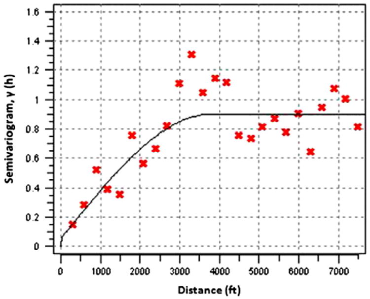
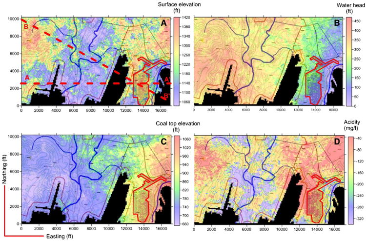
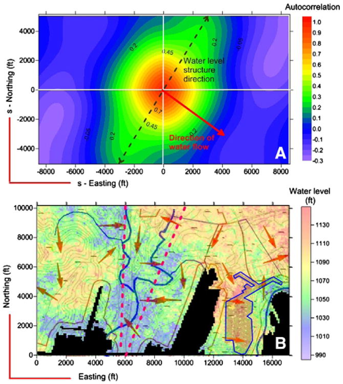
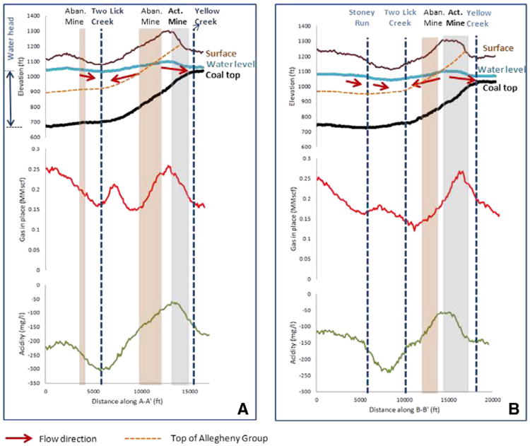
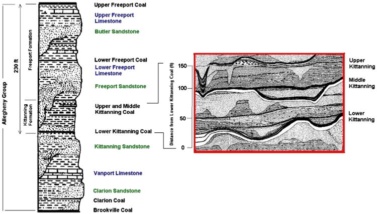
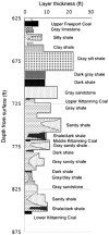
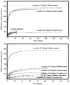
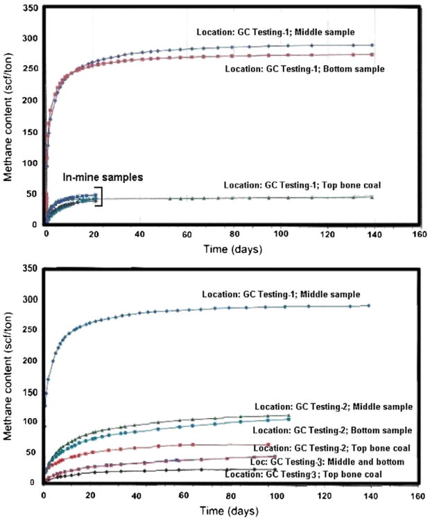
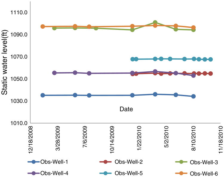
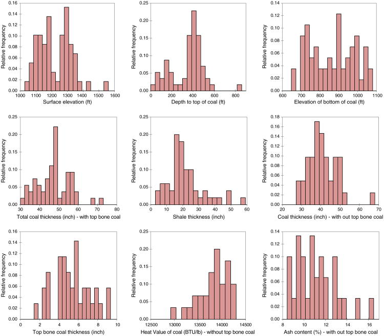
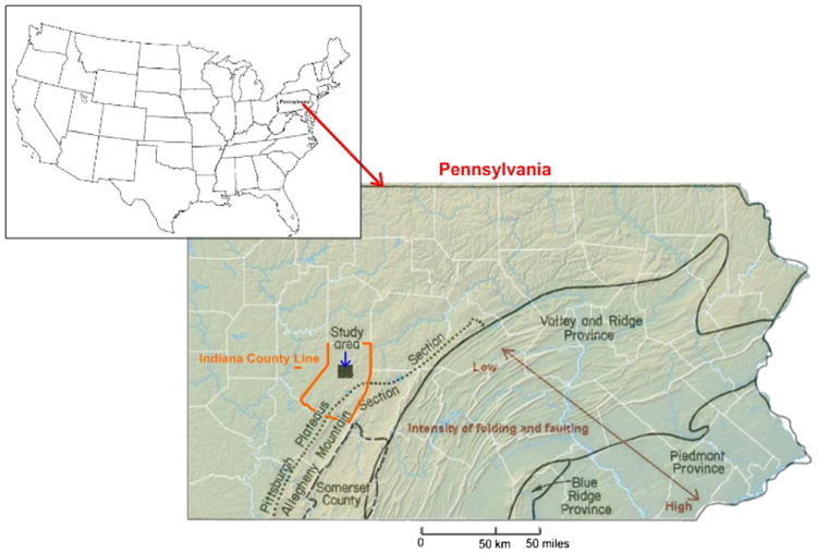
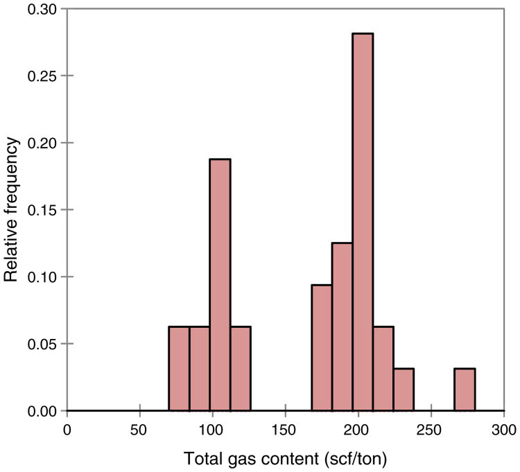
Description:This paper presents a study assessing potential factors and migration paths of methane emissions experienced in a room-and-pillar mine in Lower Kittanning coal, Indiana County, Pennsylvania. Methane emissions were not excessive at idle mining areas, but significant methane was measured during coal mining and loading. Although methane concentrations in the mine did not exceed 1% limit during operation due to the presence of adequate dilution airflow, the source of methane and its migration into the mine was still a concern. In the course of this study, structural and depositional properties of the area were evaluated to assess complexity and sealing capacity of roof rocks. Composition, gas content, and permeability of Lower Kittanning coal, results of flotation tests, and geochemistry of groundwater obtained from observation boreholes were studied to understand the properties of coal and potential effects of old abandoned mines within the same area. These data were combined with the data obtained from exploration boreholes, such as depths, elevations, thicknesses, ash content, and heat value of coal. Univariate statistical and principal component analyses (PCA), as well as geostatistical simulations and co-simulations, were performed on various spatial attributes to reveal interrelationships and to establish area-wide distributions. These studies helped in analyzing groundwater quality and determining gas-in-place (GIP) of the Lower Kittanning seam. Furthermore, groundwater level and head on the Lower Kittanning coal were modeled and flow gradients within the study area were examined. Modeling results were interpreted with the structural geology of the Allegheny Group of formations above the Lower Kittanning coal to understand the potential source of gas and its migration paths. Analyses suggested that the source of methane was likely the overlying seams such as the Middle and Upper Kittanning coals and Freeport seams of the Allegheny Group. Simulated ground-water water elevations, gradients of groundwater flow, and the presence of recharge and discharge locations at very close proximity to the mine indicated that methane likely was carried with groundwater towards the mine entries. Existing fractures within the overlying strata and their orientation due to the geologic conditions of the area, and activation of slickensides between shale and sandstones due to differential compaction during mining, were interpreted as the potential flow paths.
-
Subjects:
-
Source:
-
Pubmed ID:26478644
-
Pubmed Central ID:PMC4608864
-
Document Type:
-
Funding:
-
Collection(s):
-
Main Document Checksum:
-
Download URL:
-
File Type:
Supporting Files
-

gif 
jpeg 
gif 
jpeg 
gif 
jpeg 
gif 
jpeg 
gif 
jpeg 
bin 
gif 
jpeg 
gif 
jpeg 
gif 
jpeg 
gif 
jpeg 
gif 
jpeg 
xml 
gif 
jpeg 
gif 
jpeg 
gif 
jpeg 
gif 
jpeg 
gif 
jpeg 
gif 
jpeg 
gif 
jpeg

