Geocoding accuracy and the recovery of relationships between environmental exposures and health
Supporting Files

-
Apr 03 2008
-
Details
-
Alternative Title:Int J Health Geogr
-
Personal Author:
-
Description:Background
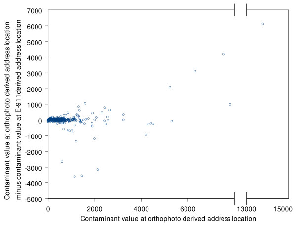
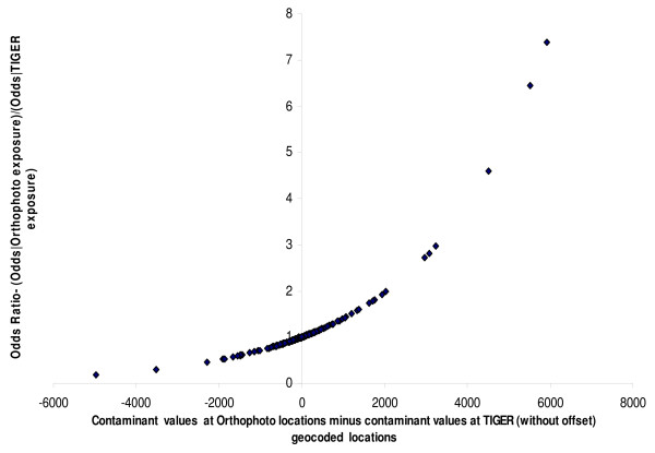
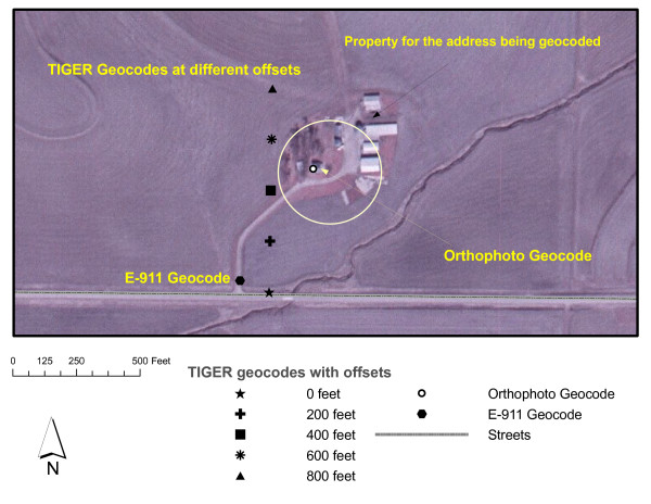
This research develops methods for determining the effect of geocoding quality on relationships between environmental exposures and health. The likelihood of detecting an existing relationship – statistical power – between measures of environmental exposures and health depends not only on the strength of the relationship but also on the level of positional accuracy and completeness of the geocodes from which the measures of environmental exposure are made. This paper summarizes the results of simulation studies conducted to examine the impact of inaccuracies of geocoded addresses generated by three types of geocoding processes: a) addresses located on orthophoto maps, b) addresses matched to TIGER files (U.S Census or their derivative street files); and, c) addresses from E-911 geocodes (developed by local authorities for emergency dispatch purposes).
Results
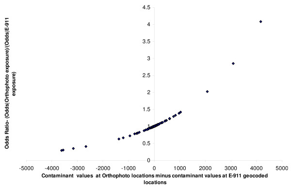
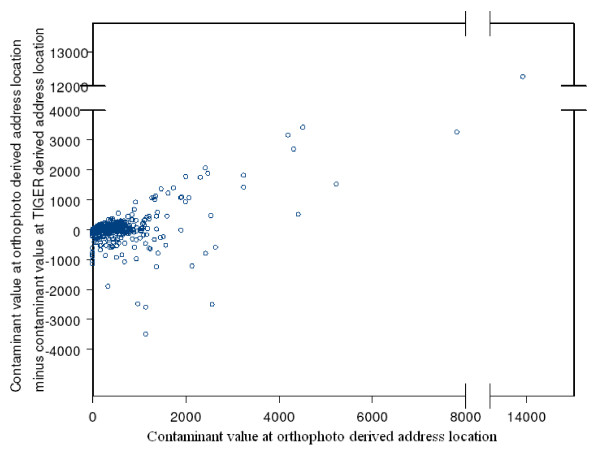
The simulated odds of disease using exposures modelled from the highest quality geocodes could be sufficiently recovered using other, more commonly used, geocoding processes such as TIGER and E-911; however, the strength of the odds relationship between disease exposures modelled at geocodes generally declined with decreasing geocoding accuracy.
Conclusion
Although these specific results cannot be generalized to new situations, the methods used to determine the sensitivity of results can be used in new situations. Estimated measures of positional accuracy must be used in the interpretation of results of analyses that investigate relationships between health outcomes and exposures measured at residential locations. Analyses similar to those employed in this paper can be used to validate interpretation of results from empirical analyses that use geocoded locations with estimated measures of positional accuracy.
-
Subjects:
-
Source:Int J Health Geogr. 2008; 7:13.
-
Document Type:
-
Funding:
-
Volume:7
-
Collection(s):
-
Main Document Checksum:urn:sha256:8e7d1c637d252cbf1d88cf8264d4dbd9e00c53b4c49d8135686250b74573f86a
-
Download URL:
-
File Type:
 [PDF
- 927.72 KB
]
[PDF
- 927.72 KB
]
Supporting Files

ON THIS PAGE

CDC STACKS serves as an archival repository of CDC-published products including
scientific findings,
journal articles, guidelines, recommendations, or other public health information authored or
co-authored by CDC or funded partners.
As a repository, CDC STACKS retains documents in their original published format to ensure public access to scientific information.
As a repository, CDC STACKS retains documents in their original published format to ensure public access to scientific information.
You May Also Like
COLLECTION
CDC Public Access