i
GIS Walking Maps to Promote Physical Activity in Low-Income Public Housing Communities: a Qualitative Examination
-
Dec 15 2011
-
Source: Prev Chronic Dis. 2012; 9.
 [PDF-214.76 KB]
Details:
-
Alternative Title:Prev Chronic Dis
-
Personal Author:
-
Description:Introduction
Walking is the most commonly reported leisure-time activity. Members of racial/ethnic minority groups and people of low socioeconomic status disproportionately live in urban environments that are perceived to be unsafe, thereby reducing opportunities for engaging in walking. We examined the use of walking maps for increasing physical activity (PA) among low-income residents of public housing sites in Boston, Massachusetts.
Methods
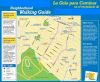
PA facilities, local businesses, and destinations in a walkable half-mile radius of the housing community were identified and plotted on maps by using geographic information systems technology. Four focus groups (n = 24) were conducted to learn how the walking maps were used by the residents and to understand map features that promoted use.
Results
Maps were used by participants to increase their PA, and use of the maps increased participants' awareness of community resources. Maps changed participants' perception of distances and were discussed as a means of fostering a sense of community. Use of the maps also increased participants' awareness of neighborhood incivilities. Barriers to map use were difficulty in interpreting the maps and lack of access to the maps.
Conclusion
Walking maps that display PA opportunities and resources may be useful in increasing walking among residents of public housing sites.
-
Subjects:
-
Source:
-
Document Type:
-
Place as Subject:
-
Location:
-
Collection(s):
-
Main Document Checksum:
-
Download URL:
-
File Type:


