Using a Geographic Information System to Improve Childhood Lead-Screening Efforts
Supporting Files
Public Domain

-
Jun 13 2013
File Language:
English
Details
-
Journal Article:Preventing Chronic Disease (PCD)
-
Personal Author:
-
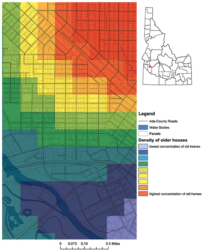
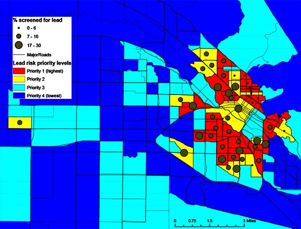
Description:The Idaho Division of Public Health conducted a pilot study to produce a lead-exposure-risk map to help local and state agencies better target childhood lead-screening efforts. Priority lead-screening areas, at the block group level, were created by using county tax assessor data and geographic information system software. A series of maps were produced, indicating childhood lead-screening prevalence in areas in which there was high potential for exposure to lead. These maps could enable development of more systematically targeted and cost-effective childhood lead-screening efforts.
-
Subjects:
-
Source:Prev Chronic Dis. 10.
-
ISSN:1545-1151
-
Document Type:
-
Volume:10
-
Collection(s):
-
Main Document Checksum:urn:sha-512:df71d62b88764a2284bcc706007c0fbdac16fbddc6989993310c6e66701314210e162361ace9c82074388fb5527070b0945ea07fbc03457fe8bde1ec80d600fd
-
Download URL:
-
File Type:
 [PDF
- 536.09 KB
]
[PDF
- 536.09 KB
]
Supporting Files

File Language:
English
ON THIS PAGE

CDC STACKS serves as an archival repository of CDC-published products including
scientific findings,
journal articles, guidelines, recommendations, or other public health information authored or
co-authored by CDC or funded partners.
As a repository, CDC STACKS retains documents in their original published format to ensure public access to scientific information.
As a repository, CDC STACKS retains documents in their original published format to ensure public access to scientific information.
You May Also Like
COLLECTION
Preventing Chronic Disease