
i
Characterizing Rigging Crew Proximity to Hazards on Cable Logging Operations Using GNSS-RF: Effect of GNSS Positioning Error on Worker Safety Status
-
Sep 23 2017
Source: Forests. 8(10)
 [PDF-1.29 MB]
Details:
-
Alternative Title:Forests
-
Personal Author:
-
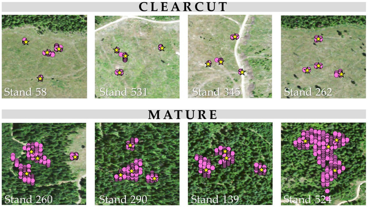
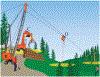
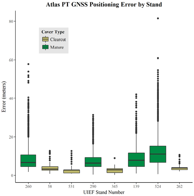
Description:Logging continues to rank among the most lethal occupations in the United States. Though the hazards associated with fatalities are well-documented and safe distances from hazards is a common theme in safety education, positional relationships between workers and hazards have not been quantified previously. Using GNSS-RF (Global Navigation Satellite System-Radio Frequency) transponders that allow real-time monitoring of personnel, we collected positioning data for rigging crew workers and three common cable logging hazards: a log loader, skyline carriage, and snag. We summarized distances between all ground workers and each hazard on three active operations and estimated the proportion of time crew occupied higher-risk areas, as represented by geofences. We then assessed the extent to which positioning error associated with different stand conditions affected perceived worker safety status by applying error sampled in a separate, controlled field experiment to the operational data. Root mean squared error was estimated at 11.08 m in mature stands and 3.37 m in clearcuts. Simulated error expected for mature stands altered safety status in six of nine treatment combinations, whereas error expected for clearcuts affected only one. Our results show that canopy-associated GNSS error affects real-time geofence safety applications when using single-constellation American Global Positioning System transponders.
-
Subjects:
-
Source:
-
Pubmed ID:30976381
-
Pubmed Central ID:PMC6456079
-
Document Type:
-
Collection(s):
-
Main Document Checksum:
-
Download URL:
-
File Type:
Supporting Files
-

gif 
jpeg 
gif 
jpeg 
xml 
gif 
jpeg 
gif 
jpeg 
gif 
jpeg 
gif 
jpeg


More +


 Email
CDC-INFO
Email
CDC-INFO


