
i
Evaluation of seismic potential in a longwall mine with massive sandstone roof under deep overburden
-
Jan 2018
Source: Int J Min Sci Technol. 28(1):115-119.
 [PDF-620.12 KB]
Details:
-
Alternative Title:Int J Min Sci Technol
-
Personal Author:
-
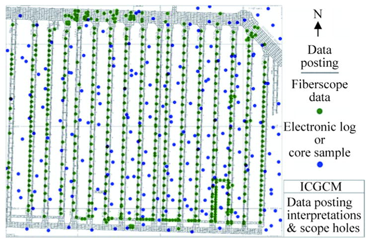
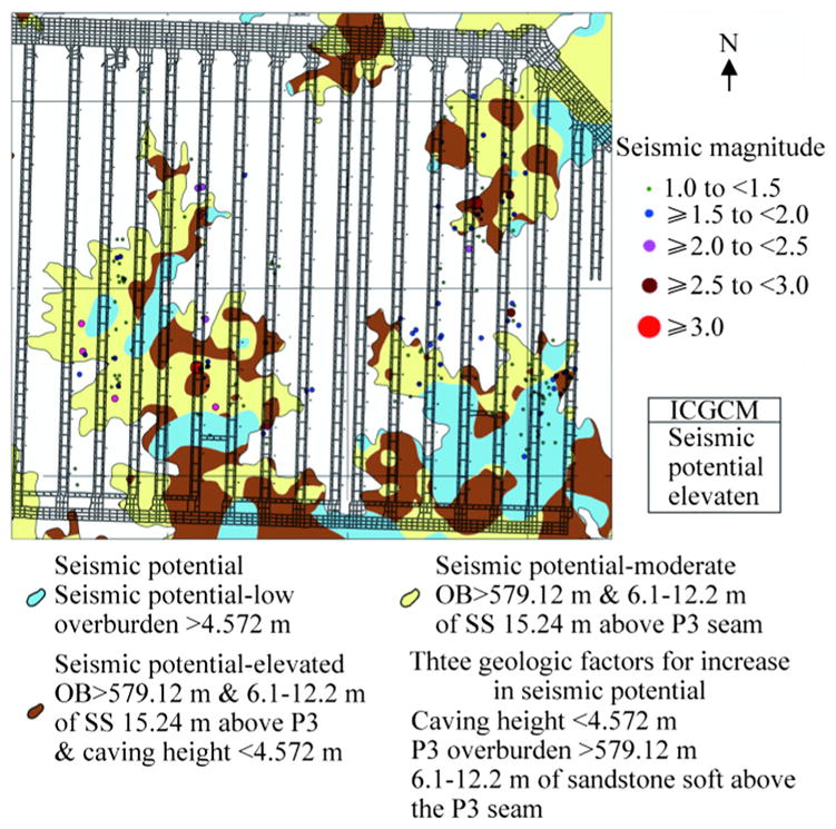
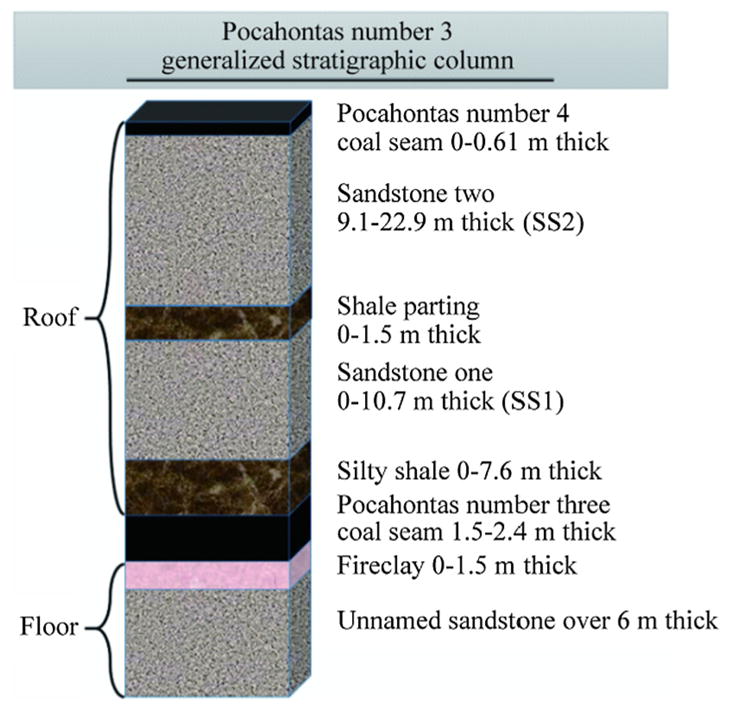
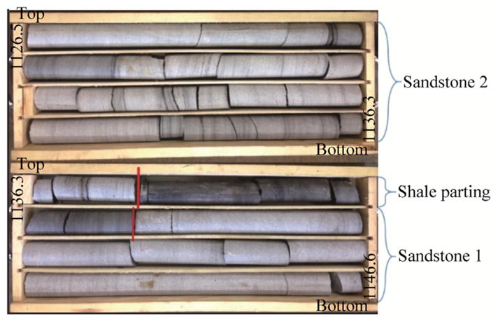
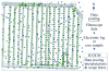
Description:A recent seismic event was recorded by a deep longwall mine in Virginia at 3.7 ML on the local magnitude scale and 3.4 MMS by the United States Geological Survey (USGS) in 2016. Further investigations by the National Institute for Occupational Safety and Health (NIOSH) and Coronado Coal researchers have shown that this event was associated with geological features that have also been associated with other, similar seismic events in Virginia. Detailed mapping and geological exploration in the mining area has made it possible to forecast possible locations for future seismic activity. In order to use the geology as a forecaster of mining-induced seismic events and their energy potential, two primary components are needed. The first component is a long history of recorded seismic events with accurately plotted locations. The second component is a high density of geologic data within the mining area. In this case, 181 events of 1.0 M| or greater were recorded by the mine's seismic network between January, 2009, and October, 2016. Within the mining area, 897 geophysical logs, 224 core holes, and 1031 fiberscope holes were examined by mine geologists. From this information, it was found that overburden thickness, sandstone thickness, and sandstone quality contributed greatly to seismic locations. After the data was analyzed, a pattern became apparent indicating that the majority of seismic events occurred under specific conditions. Three forecast maps were created based on geology of previous seismic locations. The forecast maps have shown an accuracy of within 74%-89% when compared to the recorded 181 events that were 1.0M| or greater when considering three major geological criteria of overburden thickness of 579.12 mor greater, 6.096-12.192 m of sandstone within 15.24 m of the Pocahontas number 3 seam, and a longwall caving height of 4.572 m or less.
-
Subjects:
-
Pubmed ID:30027000
-
Pubmed Central ID:PMC6049836
-
Document Type:
-
Collection(s):
-
Main Document Checksum:
-
Download URL:
-
File Type:
Supporting Files
-

jpeg 
gif 
jpeg 
gif 
jpeg 
xml 
gif 
jpeg 
gif 
jpeg 
gif 
jpeg 
gif


More +
You May Also Like
 [PDF - 8.24 MB]

 Email
CDC-INFO
Email
CDC-INFO


