
i
Antiretroviral Therapy Program Expansion in Zambézia Province, Mozambique: Geospatial Mapping of Community-Based and Health Facility Data for Integrated Health Planning
-
Oct 17 2014
Source: PLoS One. 2014; 9(10). -
Alternative Title:PLoS One
-
Personal Author:
-
Description:Objective
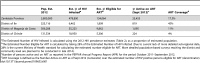
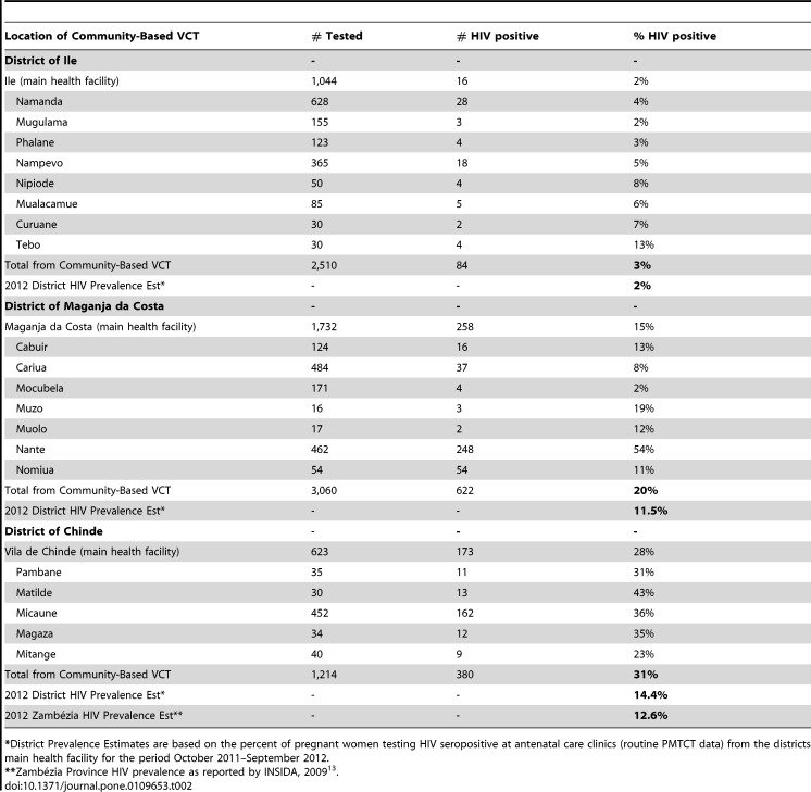
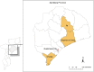
To generate maps reflecting the intersection of community-based Voluntary Counseling and Testing (VCT) delivery points with facility-based HIV program demographic information collected at the district level in three districts (Ile, Maganja da Costa and Chinde) of Zambézia Province, Mozambique; in order to guide planning decisions about antiretroviral therapy (ART) program expansion.
Methods
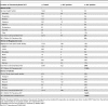
Program information was harvested from two separate open source databases maintained for community-based VCT and facility-based HIV care and treatment monitoring from October 2011 to September 2012. Maps were created using ArcGIS 10.1. Travel distance by foot within a 10 km radius is generally considered a tolerable distance in Mozambique for purposes of adherence and retention planning.
Results
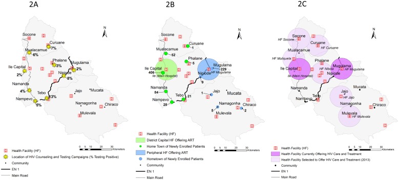
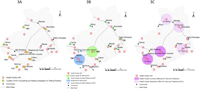
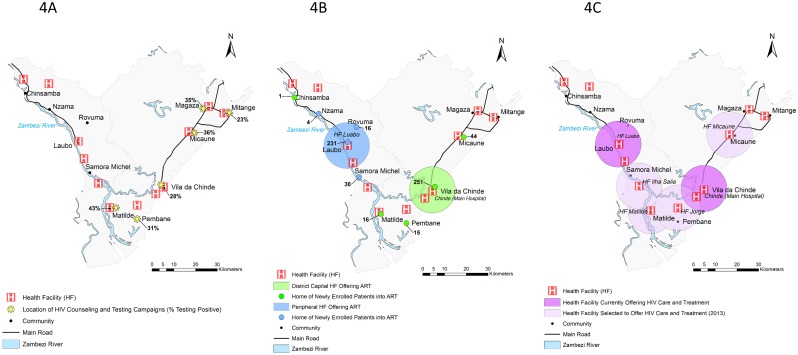
Community-based VCT activities in each of three districts were clustered within geographic proximity to clinics providing ART, within communities with easier transportation access, and/or near the homes of VCT volunteers. Community HIV testing results yielded HIV seropositivity rates in some regions that were incongruent with the Ministry of Health’s estimates for the entire district (2–13% vs. 2% in Ile, 2–54% vs. 11.5% in Maganja da Costa, and 23–43% vs. 14.4% in Chinde). All 3 districts revealed gaps in regional disbursement of community-based VCT activities as well as access to clinics offering ART.
Conclusions
Use of geospatial mapping in the context of program planning and monitoring allowed for characterizing the location and size of each district’s HIV population. In extremely resource limited and logistically challenging settings, maps are valuable tools for informing evidence-based decisions in planning program expansion, including ART.
-
Subjects:
-
Source:
-
Pubmed ID:25329169
-
Pubmed Central ID:PMC4201452
-
Document Type:
-
Place as Subject:
-
Collection(s):
-
Main Document Checksum:
-
Download URL:
-
File Type:
-

bin 
gif 
jpeg
gif 
jpeg 
gif 
jpeg 
gif 
jpeg 
gif 
jpeg 
gif 
jpeg
 [PDF-563.26 KB]
Details:
Supporting Files


More +
You May Also Like
 [PDF - 1.00 MB]
 [PDF - 74.20 KB]
 Email
CDC-INFO
Email
CDC-INFO


