
i
A national, geographic database of CDC-funded HIV prevention services: development challenges and potential applications
-
Nov 08 2005
Source: Int J Health Geogr. 2005; 4:28.
 [PDF-3.47 MB]
Details:
-
Alternative Title:Int J Health Geogr
-
Personal Author:
-
Description:Background
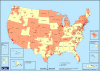
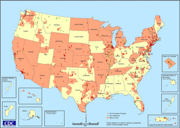
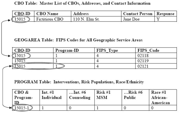
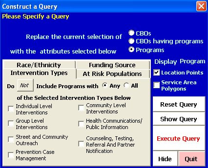
From 2000–2002, the Centers for Disease Control and Prevention (CDC) funded a study that was designed to improve the information available to program planners about the geographic distribution of CDC-funded HIV prevention services provided by community-based organizations (CBOs). Program managers at CDC recognized the potential of a geographic information system (GIS) to organize and analyze information about HIV prevention services and they made GIS a critical component of the study design. The primary objective of this study was to construct a national, geographically-referenced database of HIV prevention services provided by CDC-funded CBOs. We designed a survey instrument to collect information about the geographic service areas where CBOs provided HIV prevention services, then collected data from CBOs that received CDC funding for these services during fiscal year 2000. We developed a GIS database to link questionnaire responses with GIS map layers in a manner that would incorporate overlapping geographies, risk populations and prevention services. We collected geographic service area data in two formats: 1) geopolitical boundaries and 2) geographic distance.
Results
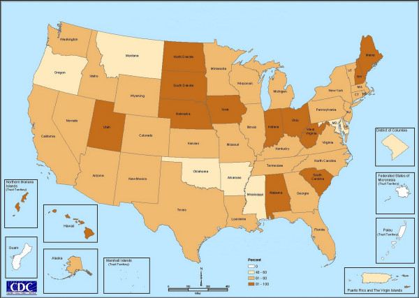
The survey response rate was 70.3%, i.e. 1,020 of 1,450 community-based organizations responded. The number of HIV prevention programs administered by each CBO ranged from 1 to 23. The survey provided information about 3,028 prevention programs, including descriptions of intervention types, risk populations, race and ethnicity, CBO location and geographic service area. We incorporated this information into a large GIS database, the HIV Prevention Services Database. The use of geopolitical boundaries provided more accurate results than geographic distance. The use of a reference map with the questionnaire improved completeness, accuracy and precision of service area data.
Conclusion
The survey instrument design and database development procedures that we used for this study successfully met our objective. The development of the HIV Prevention Services Database for CDC is an important step toward the implementation of a spatial decision support system. Due to the costs involved in a nationwide survey such as this, we recommend that future data collection efforts use Web-based survey methodologies that incorporate interactive maps.
-
Subjects:
-
Source:
-
Document Type:
-
Collection(s):
-
Main Document Checksum:
-
Download URL:
-
File Type:
Supporting Files
-

gif 
jpeg 
txt
txt 
gif 
jpeg 
gif 
jpeg 
gif 
jpeg 
gif 
jpeg

More +


 Email
CDC-INFO
Email
CDC-INFO


